

01 · Navigation
Turn-by-turn navigation
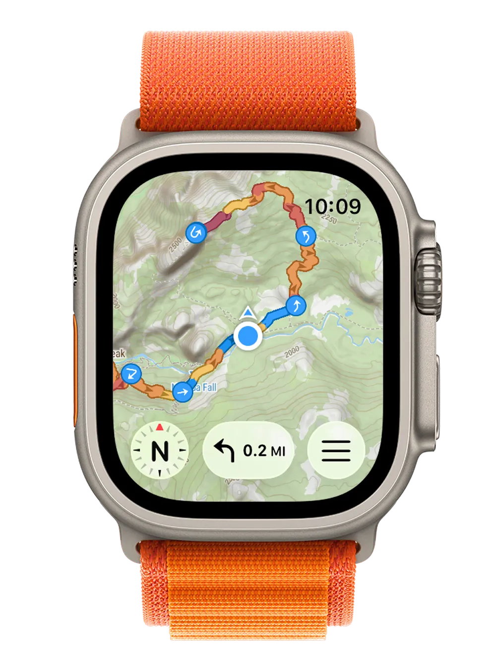
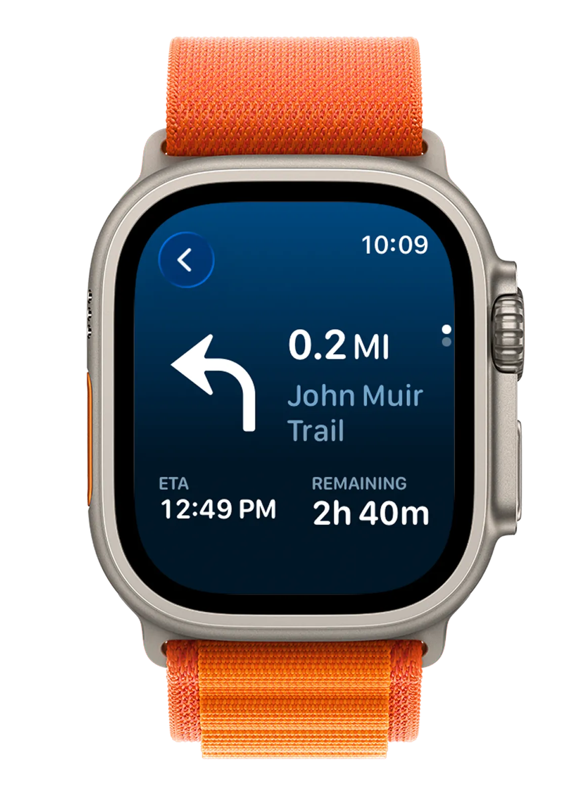
Voice guidance and visual turn alerts on your wrist. You see the next turn, the distance, and your ETA, with the phone left at home.
Voice + turn alerts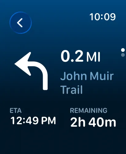
Offline topographic maps, turn-by-turn navigation, and workout recording, right on your Apple Watch. Plan on your iPhone, sync to your wrist in seconds, then leave the phone behind. It all works with no signal.
Free to start · No account · No ads
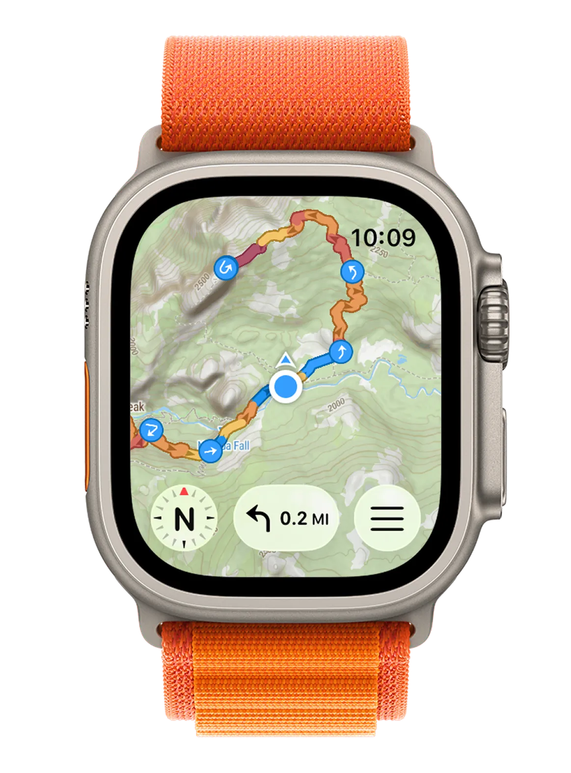
Build a route on your iPhone, save the map offline with one tap, then head out with nothing but your watch. It works without a signal.
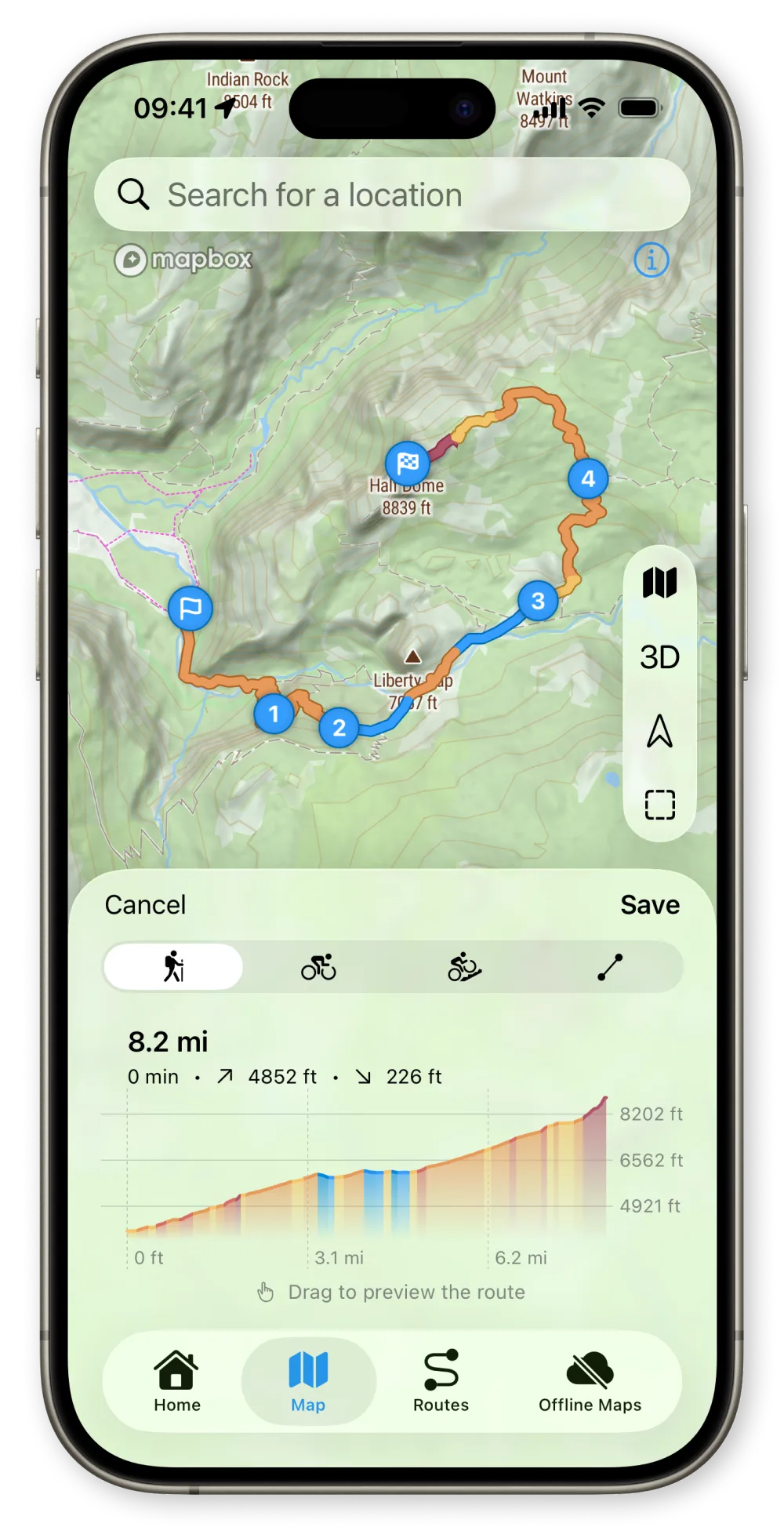
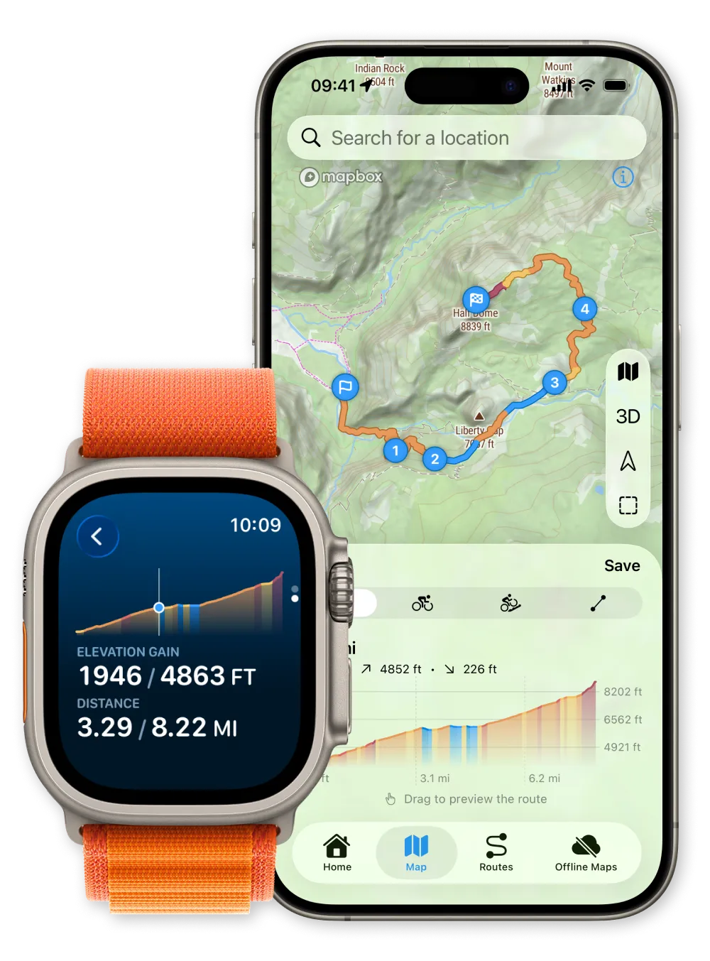
Tap to drop waypoints or import a GPX. See distance and elevation update instantly.
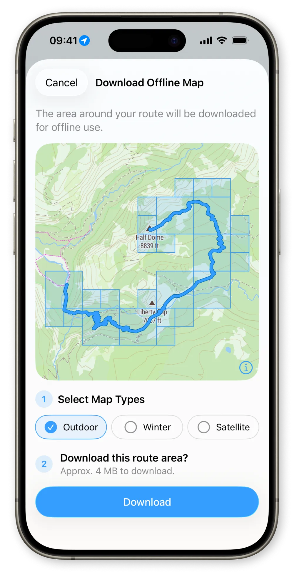
One tap downloads the map around your route. Your route is already on your watch, synced automatically.
Head out with just your watch. Turn-by-turn guidance, even with no signal.
One app, two devices: plan on iPhone, navigate on Apple Watch. Built for hiking, running, cycling, and mountain biking.
01 · Navigation
Voice guidance and visual turn alerts on your wrist. You see the next turn, the distance, and your ETA, with the phone left at home.
Voice + turn alerts 02 · Safety
Lost the trail? One tap retraces your steps with turn-by-turn guidance all the way home.
One-tap return03 · Maps
Download topographic, winter, or satellite maps to your watch. Once saved, they work with no signal, anywhere.
Works with no signal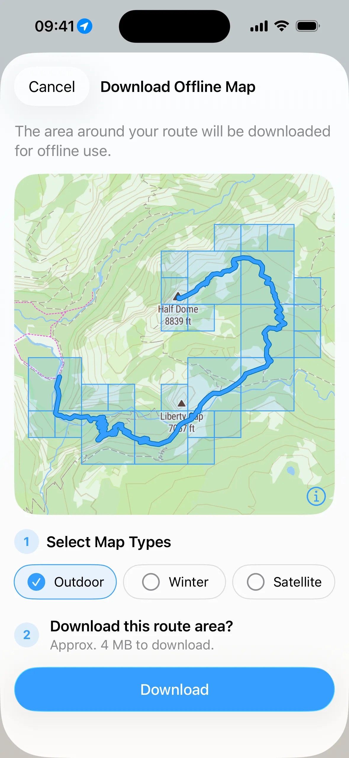
04 · Planning
Drop waypoints and your route takes shape, with distance and elevation updating as you go. Works for hiking, running, cycling, or mountain biking.
Live distance + elevation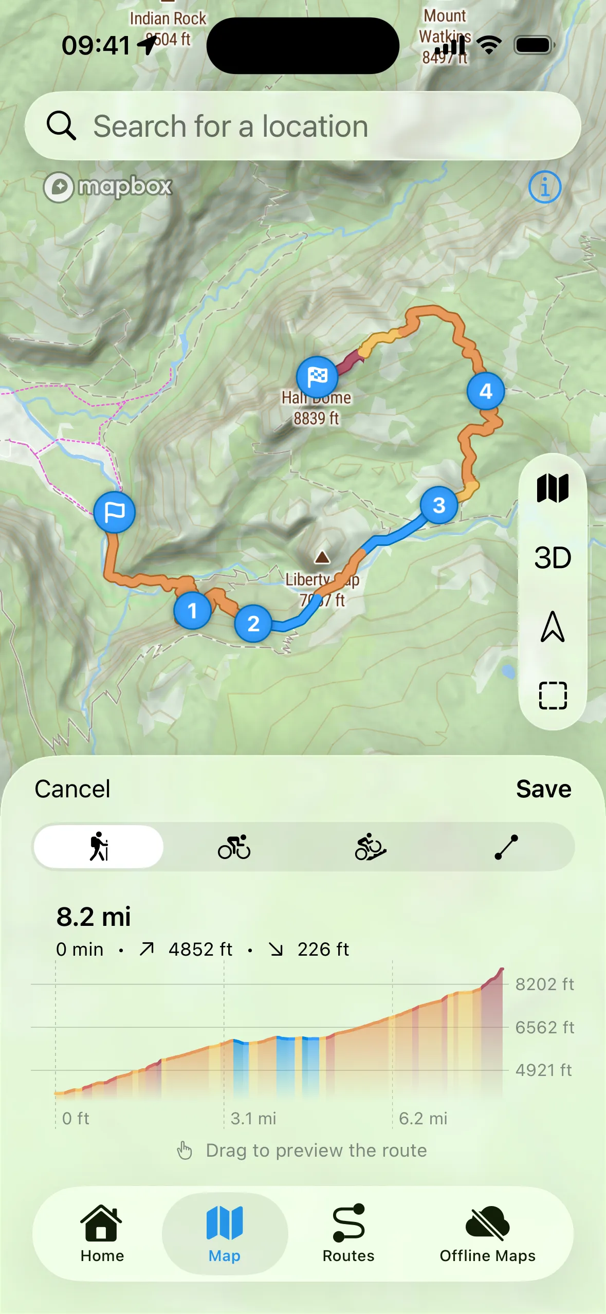
05 · Workouts
Start a workout from your wrist. It tracks distance, pace, elevation, and heart rate, saves everything to Apple Health, and counts toward your Activity rings. Since it is one app, no second tracker drains your battery.
Syncs to Apple Health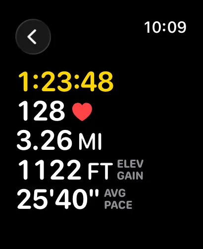
06 · On the go
Drop a destination and your watch maps a point-to-point route in seconds, right from your wrist. You never have to reach for your phone.
Phone-free, on the spot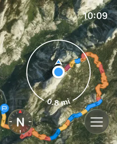
07 · Your routes
Import GPX from Komoot, Strava, or Outdooractive, and your routes sync to the watch in seconds.
Export any route as a GPX file to back it up, or share it with a friend.
Routes are colored by gradient, orange for uphill and blue for downhill, with an elevation profile you can read on your iPhone and right on your wrist. One look tells you what’s coming. Switch between topo and satellite out on the trail, with no signal.
Routing tuned to how you move, on foot, on two wheels, or on snow. Plan it on iPhone, follow it on your wrist.
Topographic contours, trail names and offline maps for every summit.
Glanceable wrist guidance, so your eyes stay on the trail instead of a screen.
Routing tuned to roads and paths, with live pace, distance and ETA.
Follow the line and the next turn without ever reaching for your phone.
Singletrack routing, with the climbs and descents colored right in.
A dedicated winter map with marked ski runs and slope names, for skiing, snowboarding, and ski touring.

The best views are usually past the point where most people turn around. Push a little deeper, take the trail you’ve never tried, and let your watch keep the way home.
Commit to the adventure. Your watch remembers the way back.

“I build WristTopo on my own. I made it because I wanted to leave my phone in my pack and still trust my watch to bring me home. No accounts, no tracking, just maps that work when you’re out there.”
Go PRO and you support one developer who hikes the same trails you do, not a corporation. There are no investors steering the roadmap and no ads to sell, so the only thing the app works toward is being useful to you. And I read every message myself: feature requests and bug reports reach the person who writes the code.
Independently covered by the Apple and outdoor press, and put to the test by heise against Komoot and Strava.
Put to the test against Komoot and Strava in heise's independent Apple Watch route-app comparison.
WristTopo meets all my requirements for a modern Apple Watch app.
Original: “WristTopo erfüllt alle meine Anforderungen an eine moderne Apple-Watch-App.”
It turns the Apple Watch into a standalone navigation tool for outdoor tours.
Original: “WristTopo verwandelt die Apple Watch in ein eigenständiges Navigations-Tool für Outdoor-Touren.”
What hikers, runners & riders around the world say after taking WristTopo onto the trail, in their own words.
This turns my Apple Watch into a gps mapping machine, and kept me from spending excessive cash just to get a Garmin watch for maps.
Outstanding, constantly improving app! … WristTopo puts the Apple Watch on par with Garmin and Suunto for hiking and backpacking, other outdoor sports, navigation, route planning, tracking, and in-route information.
Really impressed by how fluid and straightforward the route creation and map browsing is… Perfect for those that want to use the Apple Workout app but still want to follow a detailed route with turn-by-turn directions. Developer is super friendly and responsive as well!
…It turned out to be exactly the missing piece after switching from Garmin to Apple Watch Ultra. The design is outstanding — minimalist, clean… Maps load incredibly fast on the Apple Watch.
Absolutely the best Apple Watch app for hiking and trail navigation. It lets you navigate trails without needing your phone, which is a game changer… The app's battery efficiency is outstanding.
I expected this app to not work but this app has been better for offline maps for any use than Gaia maps or a lot of other apps. 10/10 app… I love the simple ui and reliable functionality.
Used this app for a three day hike in the Alps and right away purchased it. Super simple to use, fast and just a nice looking app.
Exactly what I needed. I recently climbed the Iztaccíhuatl volcano (5,230 m) and the app was perfect — battery use is almost nil, so I never worried about running out.
Completely blown away how good this app is, connecting to AW Ultra was faultless, map downloads are easy… The route planner is extremely easy to use and sticks to paths very well.
In an age of endless subscriptions, here's an app with a one-time 'forever' purchase. Intuitive, offline maps on the watch — all upsides. Highly recommend it for the trails.
An absolute incredible app that puts a beautiful topo map on your wrist where it’s quick and easy to tell where you are at all times. Highly recommended to all adventurers!
Hiking is free with just the watch — no iPhone needed. Easy to get route guidance and info right on the wrist.
This is the only app that allows to route dynamically on the watch with a topo map without creating the route on your phone. It also has turn by turn navigation and GPX import/export.
A free tier that stays free, no account required. Go PRO for $9.99 a year, or pay $29.99 once for a lifetime license, no subscription.
Everything you need for shorter adventures.
Everything WristTopo can do, unlocked.
Launch pricing: lock in today’s rate before it rises. Or pay once for the lifetime license, with no subscription. No account required, cancel anytime.

Download WristTopo and find your way with just your watch.
Free to start · No account · No ads